Land Cover Mapping
Spatial Reclassification
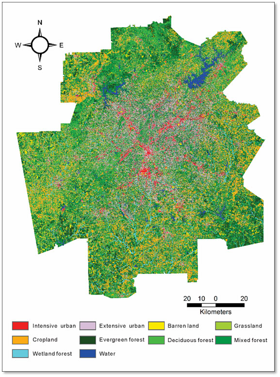
Land cover map derived from Landsat-8 Operational Land Imager (OLI) imagery. A spatial reclassification procedure was used to reorganize the class information and improve map accuracy, which involved the use of visual interpretation, manual digitizing, and ancillary data.