Comprehensive Accuracy of Daily Snow Cover Datasets
Spatial Trends of Change
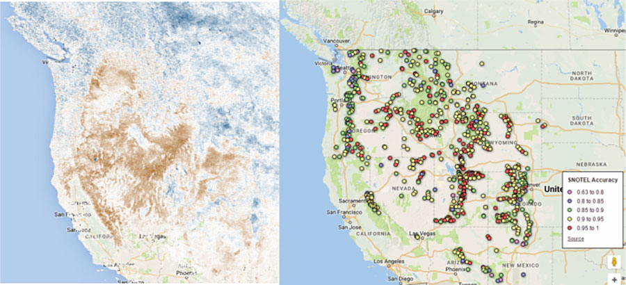
Several snow cover datasets were created and validated against more than 3 million potential points to describe the accuracy of the datasets. Using the most accurate dataset, snow cover frequency was calculated for each pixel for the last 15 years, and the trend of the snow cover frequency was calculated and mapped to help identify spatial trends of change and describe the current state of the cryosphere.